
Honalo
The first South Kona village coming down from Kailua-Kona, at the junction of the belt road and the Old Mamalahoa Highway.
Honalo is the first of the South Kona villages coming down from Kailua-Kona, a community of about a thousand people at the junction where the Old Mamalahoa Highway meets the belt road. It marks the point where the character of the coast changes: the resorts stop, the road narrows, and coffee land begins in earnest. The Daifukuji Soto Mission, a Buddhist temple that has served the district since the plantation era, sits directly on the highway and remains active. The village itself is compact, a few restaurants and shops strung along the road rather than a town center. The elevation puts it in the comfortable band, warm without being hot, with cloud arriving most afternoons. It is a practical, unfussy place that a good many people drive through without noticing they have arrived in South Kona.

Kainaliu
A single stretch of historic storefronts and one of the most intact old towns in Kona. Home of the Aloha Theatre.
Kainaliu is a single stretch of historic storefronts on the highway and one of the most intact old towns in Kona. It is small enough to walk in a few minutes and has largely resisted modernizing, so the wooden false-front buildings still hold the shops, cafes and the Aloha Theatre, a community playhouse that has been the cultural anchor of South Kona for decades. Behind the road the land climbs straight into coffee and macadamia. It is the sort of place where the same families have run the same businesses across generations and the grocery still knows people by name. The elevation keeps it mild, and afternoons often bring the cloud down over the town. Buyers here are usually after the village character and the farm land immediately behind it.
Kealakekua
The civic center of South Kona. Kona Community Hospital, the Konawaena schools, the library and most of the district’s shopping.
Kealakekua is the civic center of South Kona, about 2,300 people, and the place the whole district relies on for practical needs. Kona Community Hospital is here, along with the Konawaena schools, the public library and most of the everyday shopping between Kailua-Kona and Naalehu. It is also the heart of coffee country: the Greenwell Store, built by the English merchant who established Kona coffee as a recognized brand in the nineteenth century, still stands nearby and now operates alongside the Kona Coffee Living History Farm as a record of how these smallholdings actually worked. The town gave its name to one of the most recorded songs in Hawaiian music, My Little Grass Shack in Kealakekua, Hawaii, written in 1933. It sits above Kealakekua Bay on the old fault that formed the bay’s cliffs, which is why the ground drops away so suddenly to the west. It is a working town rather than a scenic one, and that is exactly its value.
Hokuli‘a
1,260 acres and about three miles of coastline below Kealakekua. A Jack Nicklaus Signature course and agricultural homesites.
Hokuli‘a occupies 1,260 acres on the coast below Kealakekua, running along roughly three miles of shoreline. It was conceived in the late 1990s as a private residential community built around open space rather than around a hotel, and there are no hotels or commercial districts inside it. Homesites run an acre or more and each carries an agricultural easement, which is why the community describes itself as an agrihood: owners grow fruit, vegetables, herbs or coffee on their own land, and a good number take it seriously. The Jack Nicklaus Signature course runs through the property and is regarded as one of the finest in the state, alongside a club with a fitness pavilion, spa, pool and tennis courts. Because the land slopes steadily to the water, ocean views are close to universal. It is the one genuinely luxury address in South Kona, and it reads quite differently from the resort communities up in Kohala.

Captain Cook
The largest community in South Kona, strung along the highway between 800 and 2,000 ft in the best coffee ground in the district.
Captain Cook is the largest community in South Kona at around 3,250 people, and it took its name from a post office: the Captain Cook Coffee Company ran one here in the early 1900s, and under the postal conventions of the day the office’s name became the town’s. A resolution has been under consideration to rename it Ka‘awaloa, meaning long landing place. Most of the town lies between 800 and 2,000 feet, the elevation band that makes this the best coffee ground in the district. Before the 1960s much of it was part of Kealakekua Ranch, founded in the 1850s, and the pattern of small farms that replaced the ranch is still legible in the parcel lines. Route 160 drops from the highway here through four winding miles to Napo‘opo‘o on Kealakekua Bay. It is a long, green, working town with ocean views from very nearly everywhere in it.

Napo‘opo‘o
At the southern end of Kealakekua Bay, four winding miles below the highway. A marine life conservation district.
Napo‘opo‘o sits at the southern end of Kealakekua Bay, at the bottom of the four-mile road down from Captain Cook. The bay has been settled for more than a thousand years and holds a dense concentration of heiau and archaeological sites; it is also where Captain James Cook was killed in February 1779, and the whole bay is listed on the National Register as a historic district. Today it is a marine life conservation district and among the best snorkeling, diving and kayaking water in the state, with a reef that is protected in practice as well as on paper. It carries one more distinction: Reverend Samuel Ruggles planted coffee cuttings here in 1828, and Kona coffee grew from them. The village itself is small, hot and quiet, sitting on lava at the water with a pebble beach and a wharf. Living down here means accepting a steep road and a long climb back to town in exchange for being on one of the most significant bays in Hawaii.

Honaunau
Above and around Pu‘uhonua o Honaunau, the place of refuge. Dense coffee country on the slope, black lava and clear coves below.
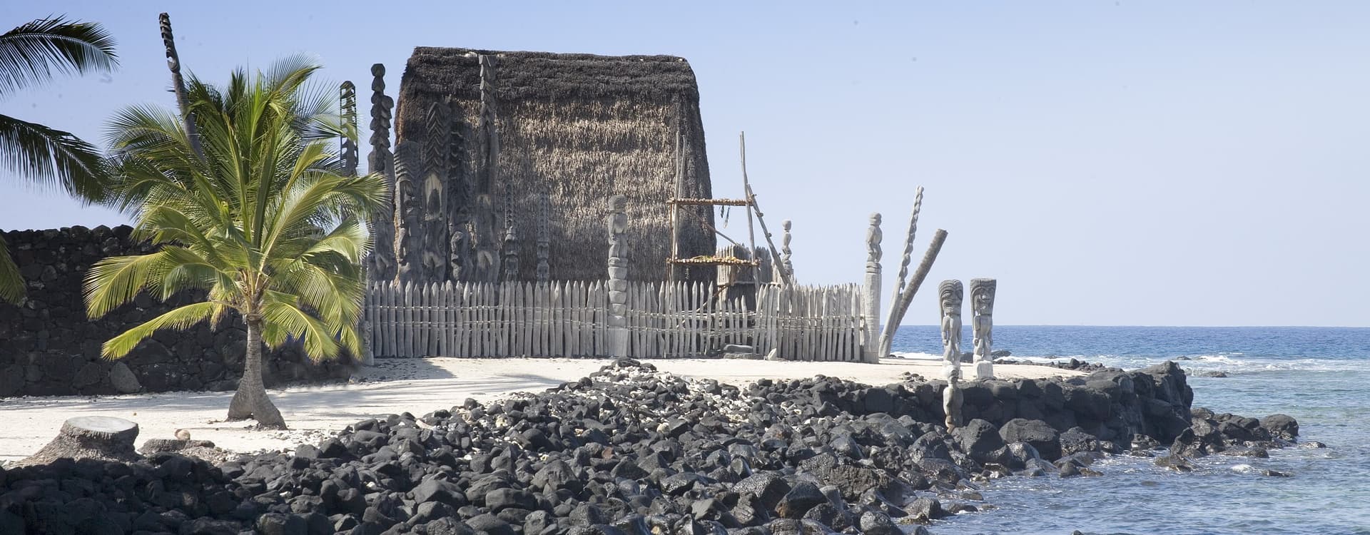
Honaunau is best known for Pu‘uhonua o Honaunau, the place of refuge, where until the early nineteenth century a Hawaiian who had broken a kapu could escape certain death by reaching the sanctuary and being absolved by a priest. Defeated warriors and non-combatants sheltered there too, and the grounds outside the Great Wall were home to several generations of powerful chiefs. The site was established by at least the fifteenth century and is now a National Historical Park, and it is one of only a handful of places in Hawaii where the Hawaiian flag may officially fly alone. Above the park the slope is dense coffee country, and Honaunau and Napo‘opo‘o together count about 2,400 residents. The shoreline is black lava, ledges and small clear coves rather than sand, and the entry beside the park is among the best on the island. Property runs from small coffee farms on the hill to a handful of places near the water, and the weight of history here is unavoidable.

Ho‘okena / Milioli‘i
The far southern end of the district. A county beach at Ho‘okena, and at Milioli‘i a fishing village living on solar and catchment.
The far southern end of the district is the quietest part of it. Ho‘okena has one of the few genuine sand beaches in South Kona, a county park on a bay reached by a steep drop from the highway. Milioli‘i, about thirty-three miles south of Kailua-Kona, calls itself the last Hawaiian fishing village, and it is not merely a slogan: the village sits where the 1926 Mauna Loa flow reached the sea, and with no power lines or water mains the houses run on their own solar panels and rainwater catchment. Its church, Hau‘oli Kamana‘o, was carried there by the tsunami of 1868 and survived the journey well enough to still be standing. Fishing remains the center of life and families here have worked the same grounds for generations. It is remote, hot and deeply local, and it is the closest thing on this coast to how the whole district once was.